

- Home
- /
- GIS Background and Experience
I have extensive experience in geographic information systems (GIS), using ArcGIS desktop, ArcGIS server, python, R, Mapserver, as well as spatial data within several flavors of databases (SQL Server, Oracle, DB2, MongoDB). My GIS experience has a focus on governmental processes (city government, water utility management, planning agency GIS analysis), as well as academic and private sector work. Please see my curriculum vitae for my specific work experience. Below are some examples of projects that I have led and acted as the primary development person. Many of these projects, I created and developed solely by myself (development, systems, architecture, and management).
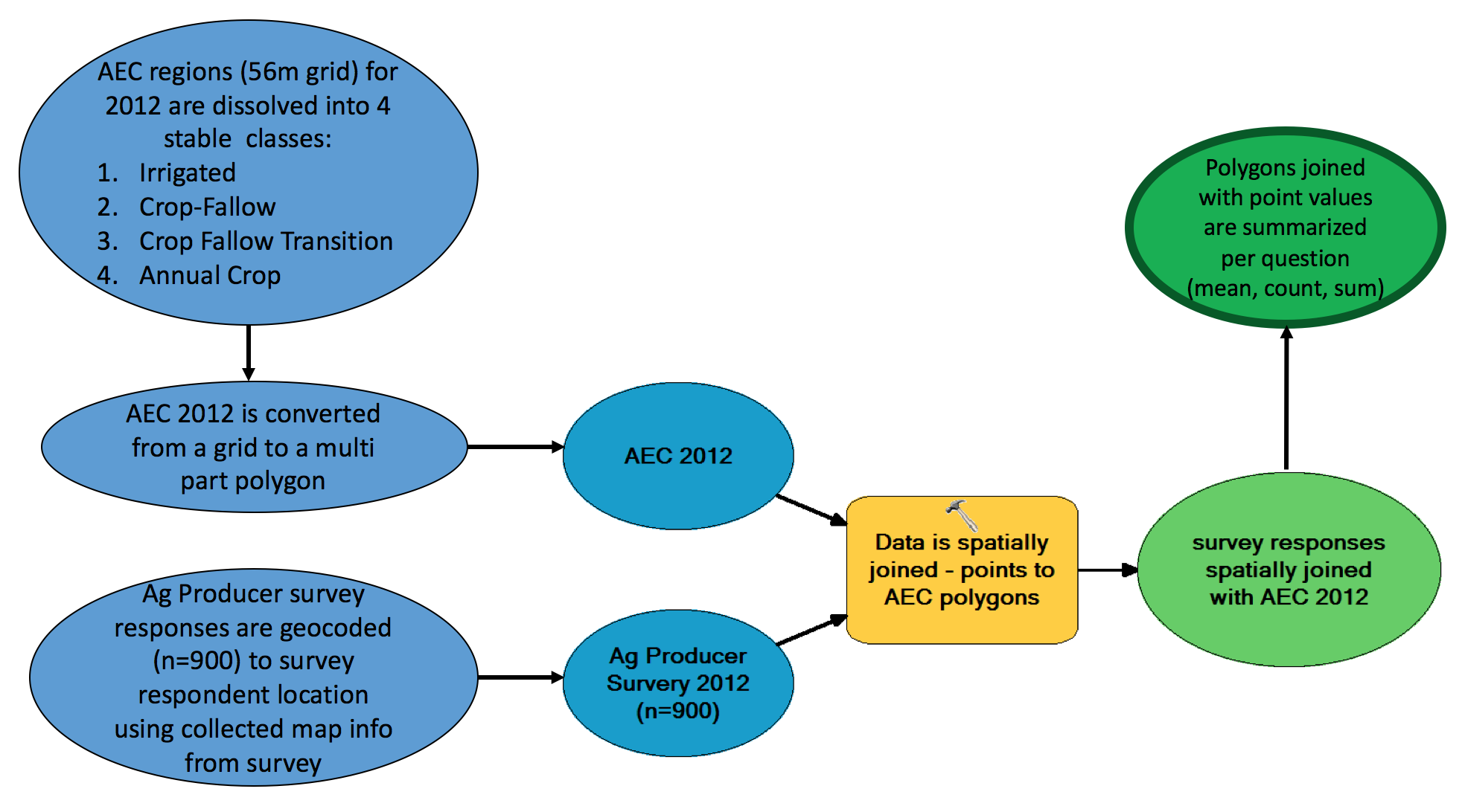
Proximity Analysis Model
Agricultural GIS modeling using cropping systems and proximity analysis
I developed an extensive GIS model that steps thru examination of USDA cropland data information, calculating crop acreage in proximity to sampling locations throughout the inland pacific northwest. This modeling effort uses python and ArcGIS, and is instantiated using ArcGIS modelbuilder as a visualization tool. The data consisted of raster USDA cropland datasets (56m pixels), along with sampling point features in Washington and Idaho. Work conducted in 2016.

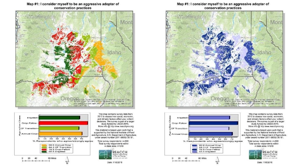
Stat Atlas Methodology
Agricultural Statistical Atlas
Along with co-authors, created a GIS-based statistical atlas that showcases results of longitudinal surveys on farmer perceptions of climate – in the context of agricultural systems. The results of this work were a series of maps that depicted farmer views on climate in relationship to differing agricultural zones. Work conducted in 2016.
ESRI Geoportal and geospatial database development for large-scale agricultural research project.
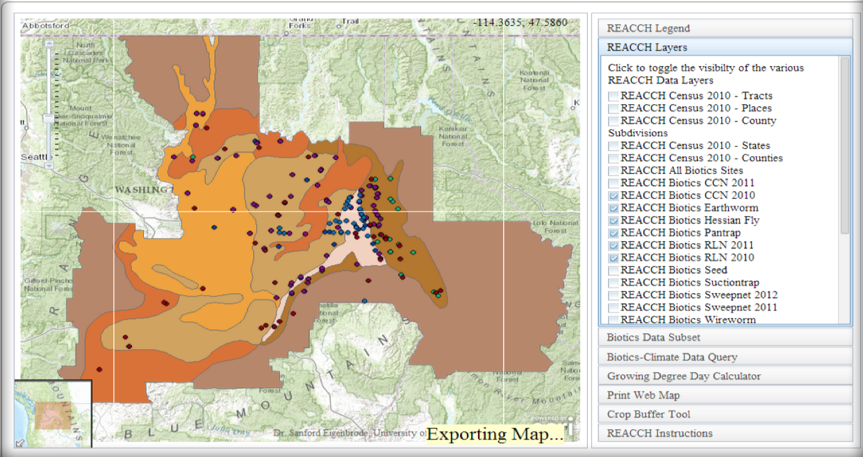
Example of REACCH ArcGIS map servic
Developed an extensive geoportal for data uploading, metadata ingestion, and ArcGIS web service exposure for a 20M USDA-funded climate science and agriculture project (www.reacchpna.org). This work ingested over 40TB of geospatially-related data, and exposed using REST protocol for consumption. The geoportal development was java-based, using ESRI-s open source geoportal server software as a basis. ArcGIS Server was used to expose over 60 different map services (image and vector services) that can be consumed using differing ArcGIS and non-ArcGIS technologies. This work was developed over several years @ the University of Idaho. I led the development and developed the architecture, built the systems on Linux servers, integrated the data, and managed the systems for a team of 200 scientists and researchers.
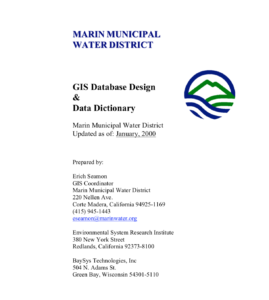
MMWD GIS Data Design and Data Dictionary
Legacy Marin Municipal Water District GIS Data Design and Data Dictionary
As part of my responsibilities as CAD/GIS Coordinator for the Marin Municipal Water District (MMWD), I developed an extensive GIS data design and data dictionary plan – a working document to outline our strategic planning approaches and data structure for water infrastructure efforts at MMWD. The plan is attached to the right (NOTE: This plan and data architecture have been updated, so this information is not of a sensitive nature).